Why Sandakphu Trek ?
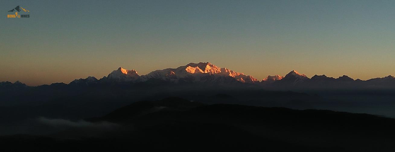
Sandakphu – You can see four of the tallest mountains in the world -
Sandakphu or Sandakfu or Sandakpur (3636 m; 11,930 ft) is the highest peak in the district of Ilam, Nepal and West Bengal, India. It is the highest point of the Singalila Ridge in Darjeeling district on the West Bengal-Nepal border. Compared to other treks in the region, Sandakphu trek difficulty, is considered easy. However, the high altitude can cause problems and weather conditions may change frequently. Therefore, you need to take necessary precautions. It’s highly recommended to plan your trip with a professional tour operator. Being the highest peak in West Bengal, offers grand views of the world’s tallest peaks. Lhotse and Makalu, the fourth and fifth highest peaks in the world stand tall at 8,516m and 8,463m, trying to outdo the world’s tallest peak. But how can they? After all, the Everest stands between them, towering over everything!
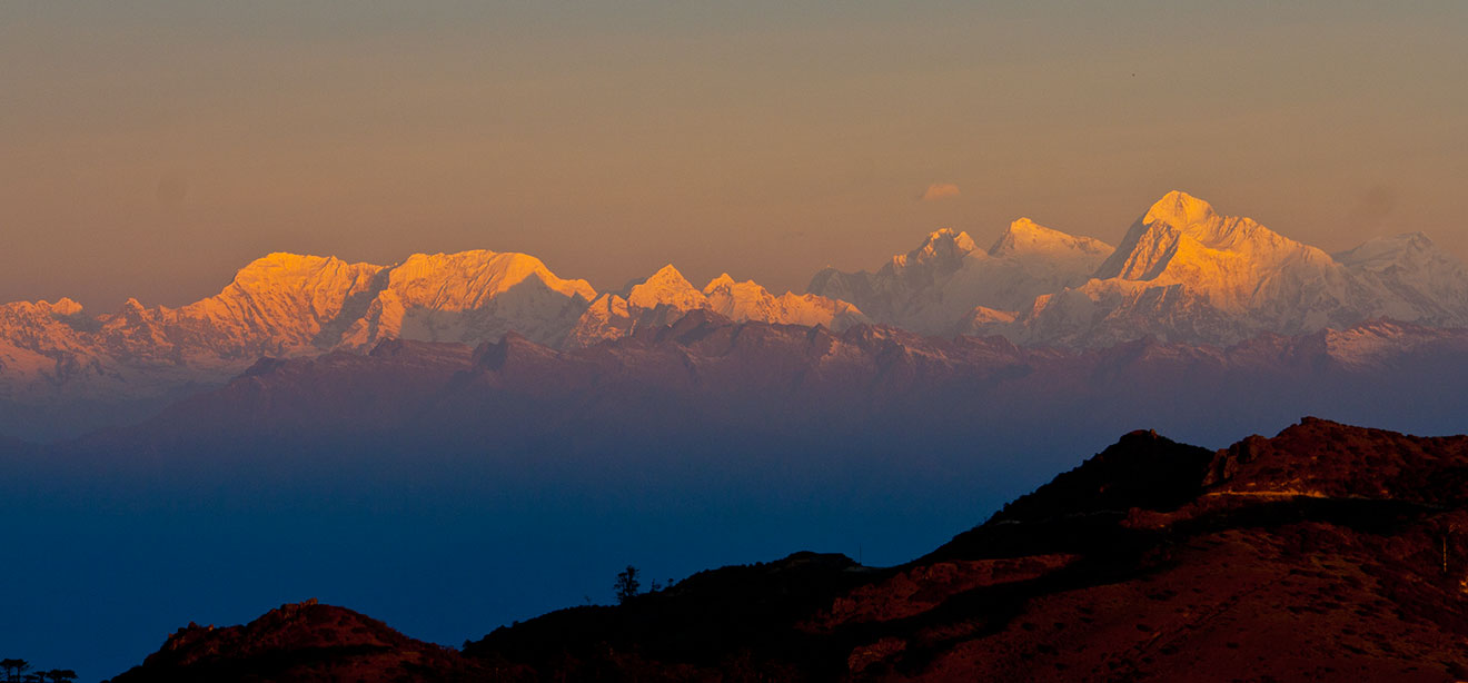
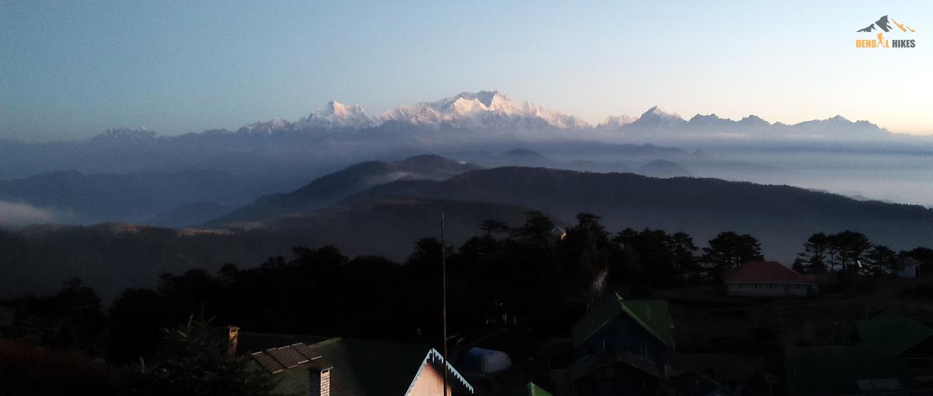
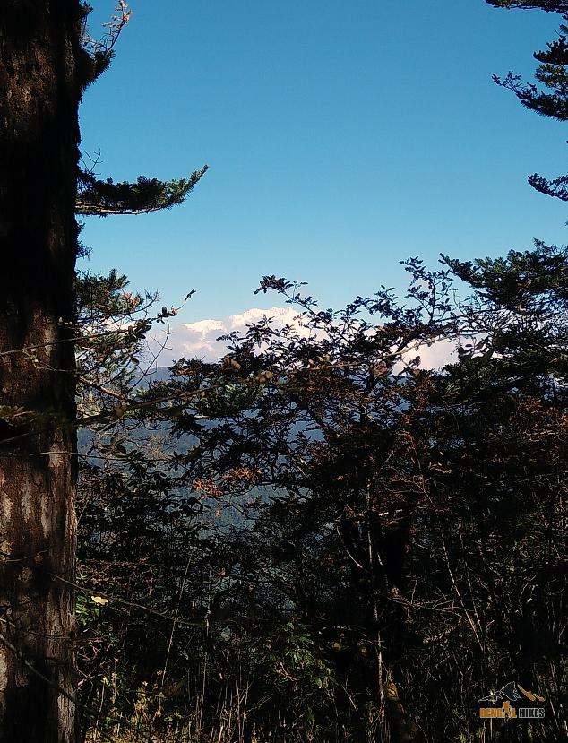
If you now start looking towards east at Sikkim, you will see the striking and prominent peaks of Kanchenjunga family (summit 28,156 ft., the third highest peak in the world). The name Kanchenjunga means "Five treasures of the snow" and has five snow peaks in its family. It is characterized by massive mass of snow. Buddhists call it 'Sleeping Buddha' and this massif is considered a holy deity in Sikkim. It is because of this sacred belief, mountaineers are not permitted to climb to the peak of Kanchenjunga. Other peaks close to Kanchenjunga include Kabru (24,026 ft), Kumbhakarna (25,294 ft.) and Pandim (22,010 ft). Between Everest and Kanchenjunga you will see the peaks of Three Sisters. If you look further east of Kanchenjunga, you will see the great Tibetan peaks of Narsing, Dongkya and Chola. And then you can spot Chamolhari in Bhutan.
What is the best time to trek to Sandakphu & Singalila?
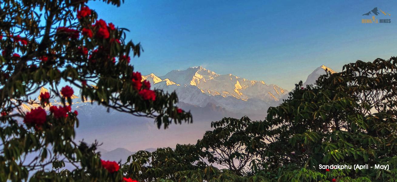
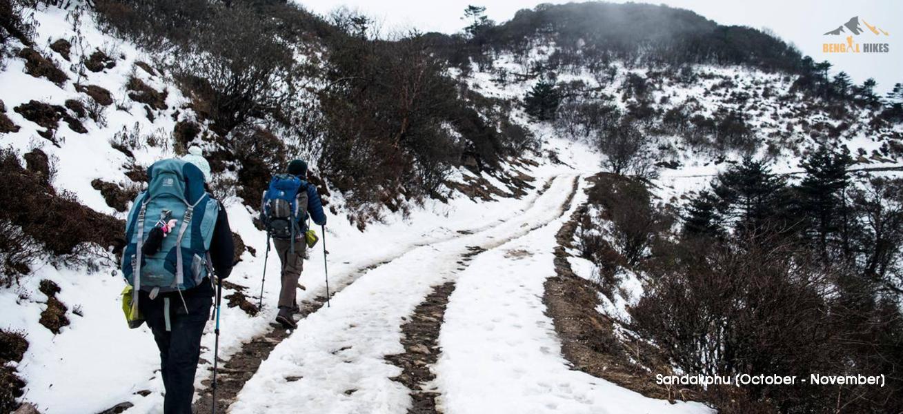
There are two great seasons firstone during April to May when it's quite comfortable (temperature ranges between 6 - 12°C) and the flowers like rhododendrons, orchid, primula are in full bloom. Sky mostly remains clear and you get lovely mountain views. In May however there are chances of occasional showers and the sky remaining cloudy at times. The second season is between October to November when the temperature ranges between 1 - 6°C, visibility is excellent and there may be occasional snowfall. You can also trek in December but it gets really cold around that time. These days Sandakphu trekking takes place in winter as well (between December - February). You will however need heavy woolens and equipment.
Sandakphu Trek Itinerary:
Day 1: Siliguri to Manebhanjang / Chitrey ( 8,340 ft ) - 90 Km – 4/5 hours
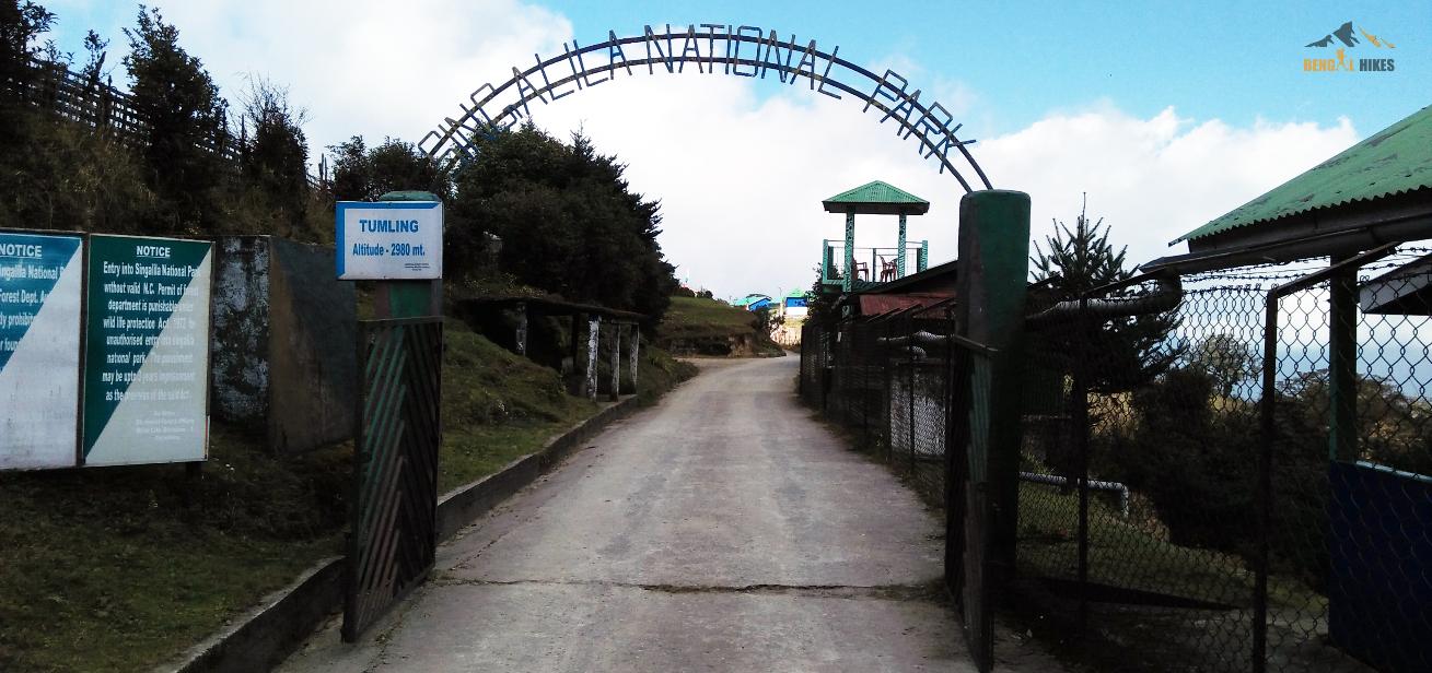
Day 2: Manebhanjang to Tumling / Chitrey to Tumling ( 10,000 ft ) - 9 Km – 7 hours
Day 3: Tamling to Kalapokhri ( 11,929 ft ) - 12 Km – 7/8 hours
Day 4: Kalapokhri to Sandakphu ( 11930 ft ) - 6 Km – 4/5 hours
Day 5: Sandakphu to Timburey via Gurdum village ( 3,572 ft ) - 15 Km – 7/8 hours
Day 6: Walk 1 and half hour to the Srikhola road head and drive to NJP - 150 Km – 6/7 hours or Darjeeling town ( 90 Km, 4 hours)
*** You need to reach latest by 9 am on Day 1 at NJP/Bagdogra. You will return to NJP/Bagdogra in 6/7 hours drive from Srikhola on Day 6, around 4-5 pm. Arrange your tickets accordingly***
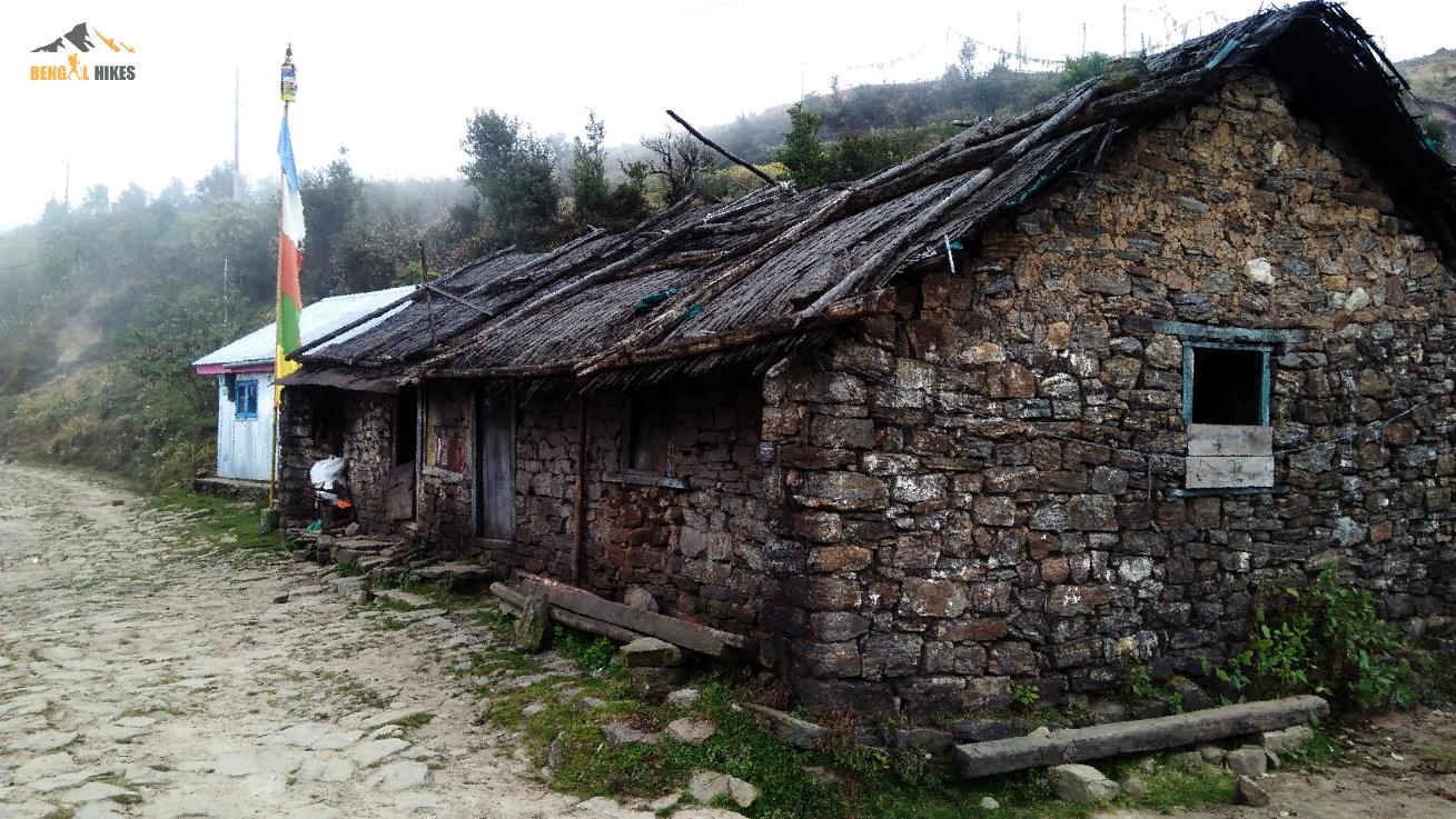
Accommodations during Sandakphu trek:
This is a “Tea House” trek, i.e we don’t camp inside Singalila National Park but stay in Homestay/Lodge available on the trail. As you should expect on a mountain trail, these are basic accommodation run by the local Nepali/Tibetan families. Rooms are dormitory bed type with triple/quad sharing or more. Beds and blankets are neat and clean. Please don’t expect an attached toilet or running water inside. This area is damper than the western Himalayan routes. Note that ***there is no electric heater or any kind of heating source in these basic lodges so keep adequate warming layer(s) as per your comfort.***
Local people and food culture:
This region in Eastern Himalaya is different than Western Himalayan states of Uttarakhand and Himachal Pradesh. There are differences in religious practices which reflect in local culture and thus in the people behavior. Majorly Buddhism is followed in Nepali and Tibetan ethnicity. People are friendly, helping and smiling. Though your major meals will consist standardized Indian meals (Rice, Roti, Dal, vegetables etc.) but expect mix of local noddles soup, momo, chowmein in lunch or snacks.
Access to Sandakphu trek basecamp:
We will arrange a pickup from NJP to Manebhanjung/Chitrey and drop from Srikhola to NJP. This will be shared by the team members on actual basis and paid directly to the driver. Typically a Tata Sumo/Mahindra Maxx type Jeep charges Rs 3500 for a drop to Chitrey and Rs 5500 from Srikhola to NJP/Bagdogra. One such car can accommodate 7 to 8 people. This cost is NOT included in the TREK FEE.
Mobile network and battery charging facility during your Sandakphu trek:
You will get network around your all the night accommodations. However the networks are not steady and working network depends upon place to place and network providers. If you switch on your international roaming then probably you will get through a call. At Chitrey and Tonglu you can charge your batteries. At Kalapokhri and Sandakphu charging facility depends on availability of generator. There is a possibility that you may charge the battery while paying for the same. It is always advised that you carry a fully charged power bank or at least a spare battery for your camera.
How to get fit for the Sandakphu trek:
Sandakphu is a moderate trek. There are no technical sections to walk on. But it is an extremely long trek. This requires a good amount of preparation.
Cardiovascular endurance
This trek requires a good amount of cardiovascular endurance. You can begin by jogging everyday. Start jogging at a slow pace and then keep increasing your pace day by day. In order to be prepared for high altitude trek, you should have a combination of distance and speed targets.
Here’s a fitness routine that works:
–>Target completing 5 km in 45 minutes when you begin.
–>Gradually increase your pace by running 4 times a week and bring it down to 5 km in less than 35 mins.
–>If you are 45 years old and above and are comfortable with long distance walking than jogging, then before you go on the trek, you should be able to walk at least 10 km at a stretch. Target completing this in 90 minutes.
If jogging is fine for you, your target should be completing 5 km in 40 minutes initially, and 5 km in less than 40 minutes before you go on the trek.
–>If you are somebody who prefers cycling over running, your target must be to cover 22 km in 60 minutes.
Day 1: Siliguri to Manebhanjang / Chitrey ( 8,340 ft ) - 90 Km – 4/5 hours
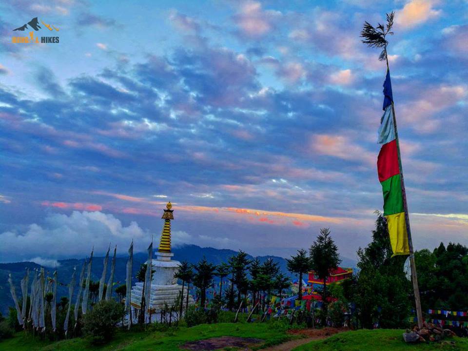
Pick up from NJP railway station in the morning by 10 am and drive to Maneybhanjang (~ 1980 m/6500 ft). Distance around 90 km and takes 5 hours with a lunch and another tea break. The road goes through the foothills of Eastern Himalaya (also called Dooars) and gradually gains altitude inside conifer forests. There are two roads to reach Maneybhanjung of which one goes through the hill town of Mirik and the other via Ghoom. Usually the car takes the Mirik – Sukhiapokhri road. Have your lunch in Mirik, a hill station beside a fairly large lake. The last 3 Km from Maneybhanjung to Chitrey is a steep road with several hairpin bends and eventually reaches the hilltop clearing at Chitrey (~ 2200 m, 7200 ft), trek basecamp for Sandakphu trek Chitrey is a small hamlet with of handful houses and a solitary lodge. In the afternoon/early evening visit Chitrey Monastery and the Buddhist Stupa beside our homestay. Walk up to the top of the hillock for sunset and a distant view of the hill queen Darjeeling city. All the major mobile networks work here. Night stay in lodge.
Day 2: Manebhanjang to Tumling / Chitrey to Tumling ( 10,000 ft ) - 9 Km – 7 hours
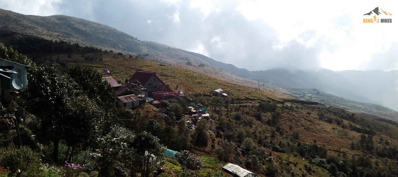
Westart off from Chitrey, a lesser used but beautiful basecamp village for treks in West Bengal. We begin early morning after breakfast on this 5-6 hour trek covering mixed ascents. Hot lunch will be provided on the way. Tumling is where the border between trekking in Nepal and India blurs and we are suddenly ushered into another country after crossing a check-post where you must keep your visa and IDs handy. There are hardly ever any restrictions for entering the place if you are an Indian. From other access points to Tumling, it is even more of a freeway. The tiny hamlet of Tumling is located at an altitude of 9, 600 ft., within motor road access from Manebhanjang and Jaubhari—the other points of ascent on the Sandakphu-Phalut trail besides Kopidana. There are about 10-12 Nepali families living in this mountain parish who run teahouse accommodations for the trekkers all year long. In addition, you will find quite a few private lodges and huts adding to services available in the area for tourists and trekkers. Since we start really early in the morn, lets expect to reach the warm hospitality waiting for us in Tumling by late afternoon around 5 while there is still plenty of light. Later, you can go over to the viewpoint at the center of Tumling from where the superb view of Kanchenjunga family of snow peaks meets the eye. The sunset at Tumling this afternoon is going to be your first of many awe-inspiring sunsets to come on this journey. From the center you are also going to find a signboard indicating towards the expanse of Singalila National Park starting right ahead, and on this way you will find the entry to park in about 1 km from Tumling. At another side you will find a high trail zigzagging towards Tonglu, another altitudinous mountain settlement. If you love Himalayan trekking in the winters you will find the well-demarcated trails used after the snowmelt season for trekking to Sandakphu, now overwhelmingly covered.
Day 3: Tamling to Kalapokhri ( 11,929 ft ) - 12 Km – 7/8 hours
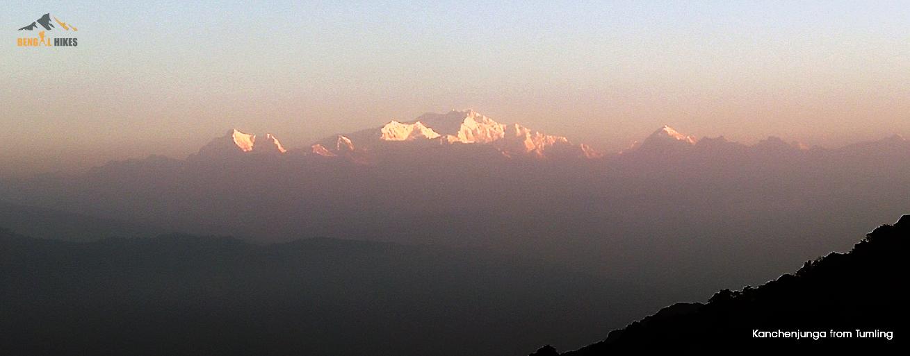
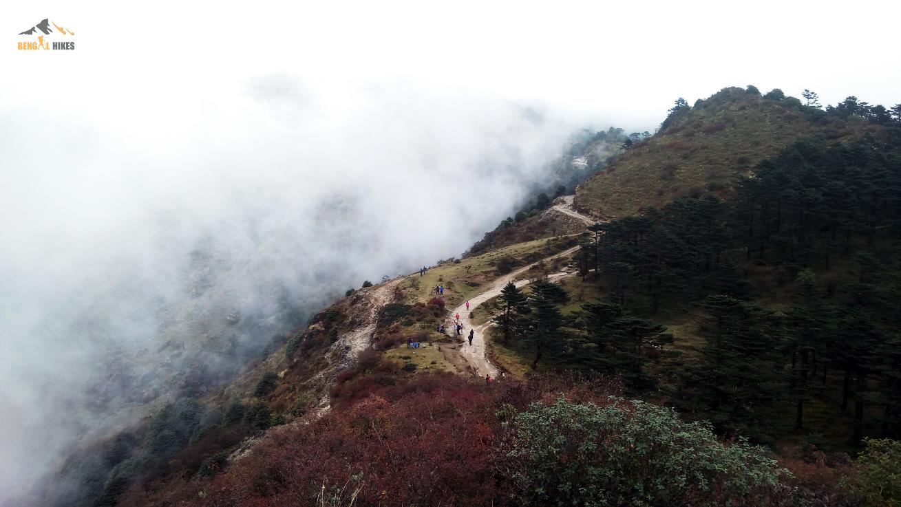
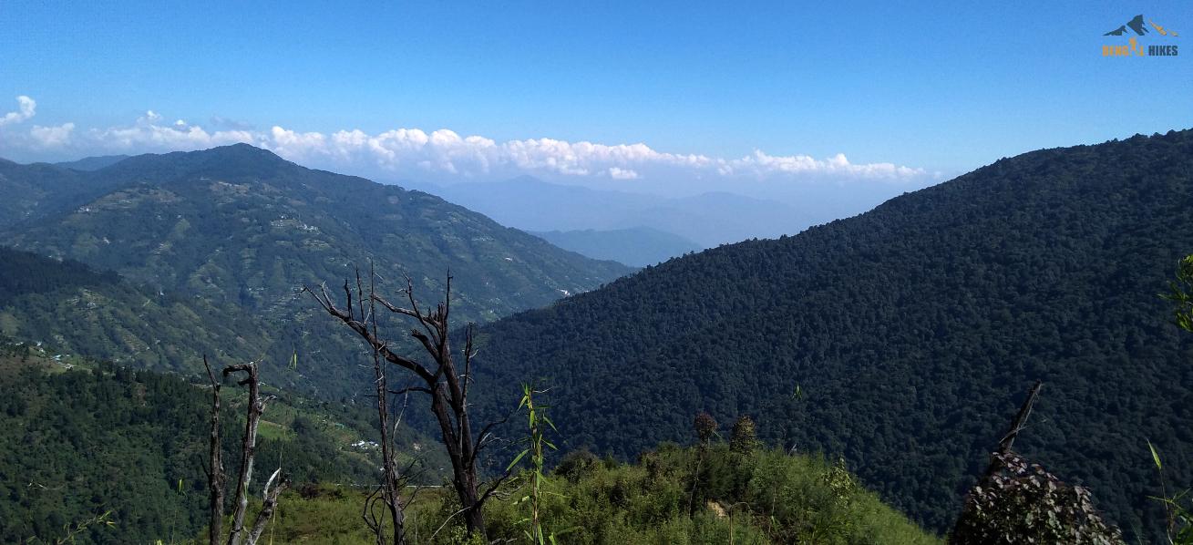
Another beautiful sunrise to look forward to on the Sanndakphu Trek comes on the morning of our 3rd day, waking up in Tumling. The magnificent Sleeping Buddha washed in the first rays of the sun gleams sublime across the sky. The entire set of Kanchenjunga peaks unveils if the sky is clear and the vision starts your day in the right mood. Look out for the prominent three in the background—the Kanchenjunga main flanked on two sides by the Kumbhakarna and Shimbho peaks. In the fore, you can make out the peaks of Goecha, the Kabru set of peaks, Rathong, Koktang, and Frey. You can also trace the hollow of Goecha La somewhere along the frontline peaks— one other of our popular treks, located in Sikkim. After breakfast we start our walk on a level ground and reach the check post of Singalila National Park in 45 minutes. From here we obtain the permit and get into the national park. Shortly after check post the road bifurcates. We leave the jeep road and take the left trail into Nepal. The terrain is wide spread and walking on the rolling trail we reach Jaubari village inside Nepal.
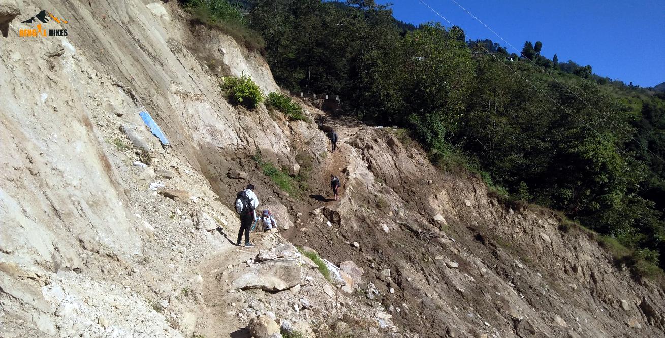
From here the main road leads to the eastern Nepal district town of Ilam while we take a right turn and descend on the stony trail. The trail far ahead is clearly visible from here and after an hour we descend to the Indian settlement called Gairibas. There is a GTA operated Trekkers Hut, SSB camp and few shop serving tea, noodles and momo. From this point our climb for the day starts. The road enters into the dense forest and we take shorts cuts often which meet the jeep road while gaining altitude in short distance.
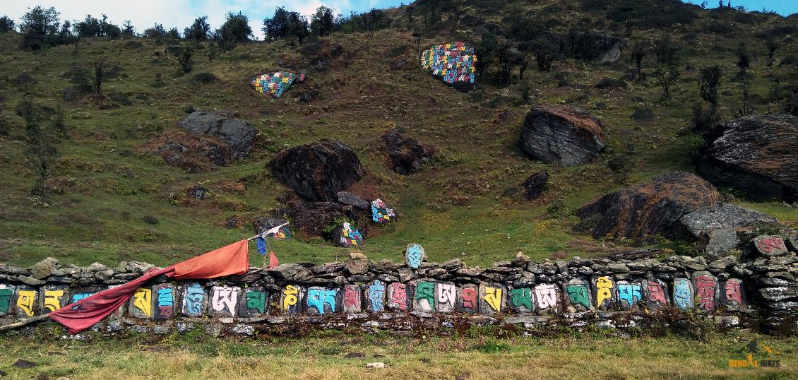
A moderate climb of one and half hour leads us to a valley and a small settlement called Kaiyakata. There is a tea stall at the left hand side of the road. Have your hot lunch here. The road ahead turns to a semicircular arc and splits. We take the right one which gradually enters into the thick forest of conifer, birch. and Rhododendron. After walking an hour spot a small lake on our left. This is called Kalapokhri (Kala is Black and Pokhri is a Pond in Nepali).
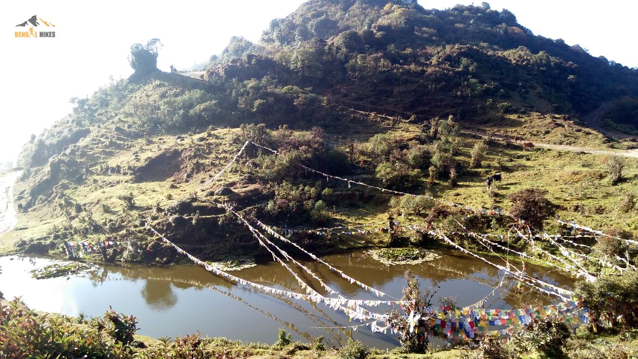
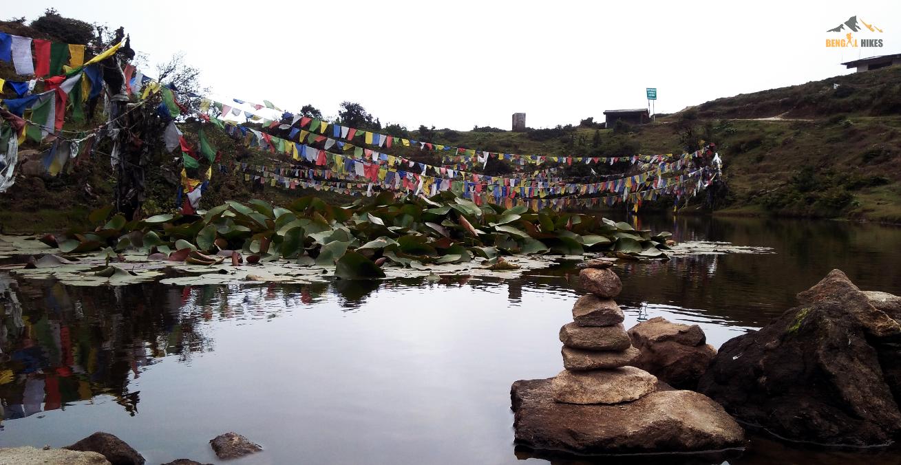
From here we take a right turn and reach our destination for the day Kalapokhri (~ 3100 m/10200 ft). There are ample lodges beside the main road strip inside Nepal and we stay in a lodge here. Total distance is 12 Km and may take 7/8 hours.
Day 4: Kalapokhri to Sandakphu ( 11930 ft ) - 6 Km – 4/5 hours
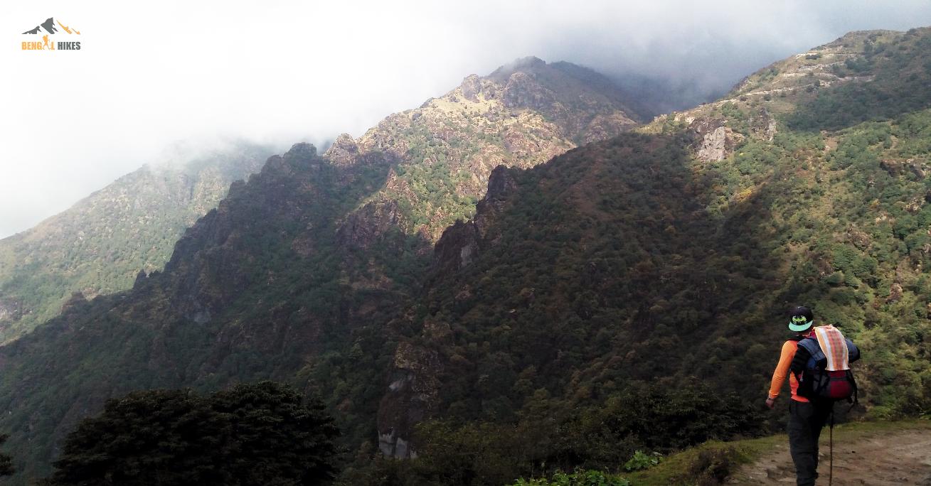
The trail from Kalipokhri to Sandakphu should be an easy trek for those sufficiently fit. The trail goes on an initial gradual ascent covering the forst 30 minutes, followed by a steeper climb for about an hour, and after that falling on a winding motor road. It’s going to be a 3 hour jaunt covering about 6 km. Reaching the flats of Bikheybhanjang, you will be looking at the vast panorama of the Sandakphu summit ahead of you. From this point, it’s another 4 km up a zigzagging route.
There is a tea stall on our left and a forest check post on the right. The road splits and the newly built road inside Nepal takes a longer path on our left to reach Sandakphu. We take the straight road ahead and start climbing. The switchback road has several turns and we go off the road and take shortcuts on few occasions. On the right hand we can see one ridge after another meeting the horizon. Silver fir, variety of conifers dominate the treeline. After ascending for an hour and half we turn left and reach the top of the ridge Sandakphu (~ 3636 m/11930 ft).
The left side of the ridge is in Nepal and the right side in India. On both sides of road there are lodges and tourist huts. The top of the ridge is somewhat flat and the north side is open. There is no ridge higher than this point, so the view of the mountains are uninterrupted. Total distance we cover is 6 Km and can take 3/4 hours. Infrequent mobile signal is available, here and there. In the late afternoon we walk on the Phalut road around an hour and witness the mellow sunset. Overnight in private lodge.
Day 5: Sandakphu to Timburey via Gurdum village ( 3,572 ft ) - 15 Km – 7/8 hours
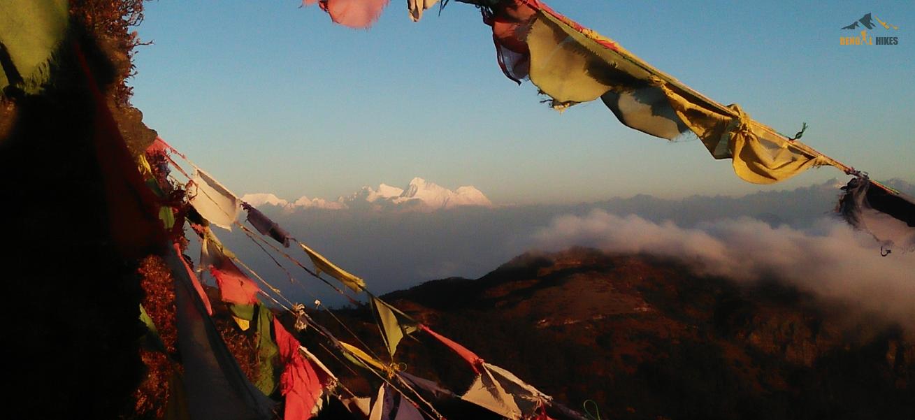
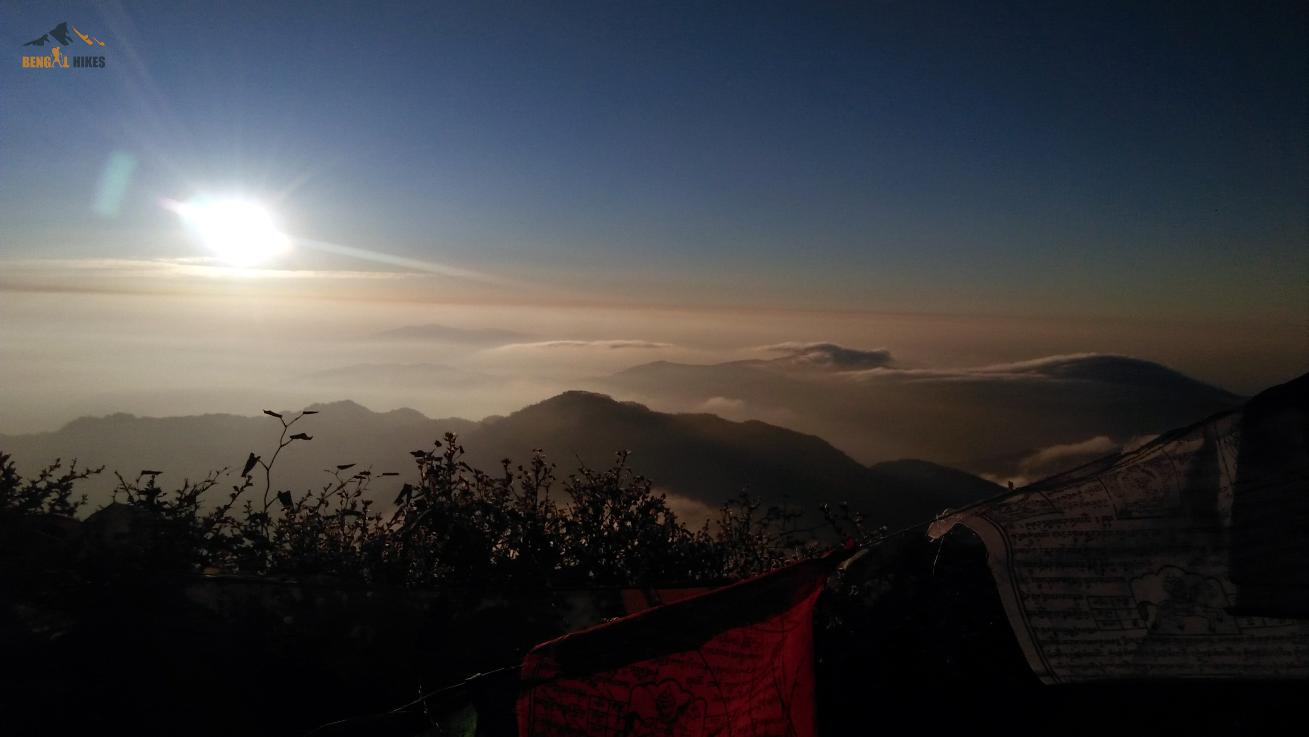
Wake up early to observe the fascinating sunrise. During fall and winters this top remains cold, specially early in the morning. Wind blows directly from Kanchendzongha side. Expect a temperature between 0°C to -10°C (with the wind chill) in fall and winters. Straight ahead is gigantic Kanchendzongha massif along with Kumbhakarna (also called Jannu) to its left and Pandim to its right, forming as rightly said the “Sleeping Buddha”. Further left in the westward direction you can spot Three Sisters, Chomo Lonzo, Makalu, Everest, Lhotse, Nuptse, Baruntse, Chamlang and other peaks . You will never forget the changing hue on Kanchendzongha.
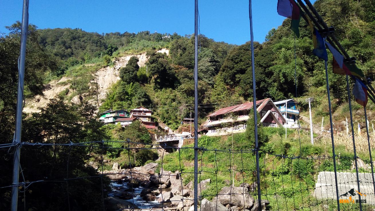
After breakfast we start our descent. Today the trail is more likely you get in the other regular treks without an accompanying motor route. Initially the trail goes inside the conifers and later into bamboo forest. The slope of the descent is moderate at stretches and mostly gentle. In 3 hours we reach on the edge of the ridge and vast valley opens up. The picturesque village of Gurdum is seen below, along with the farming fields. We take our lunch in a beautiful lodge here and continue our descent inside pine forest to our days night halt at Timburey. This is a small village beside Srikhola river (Khola means river in Nepali) with couple of home stay accommodation. Distance is around 15 Km and can take up to 8 hours.
Day 6: Walk 1 and half hour to the Srikhola road head and drive to NJP - 150 Km – 6/7 hours or Darjeeling town ( 90 Km, 4 hours)
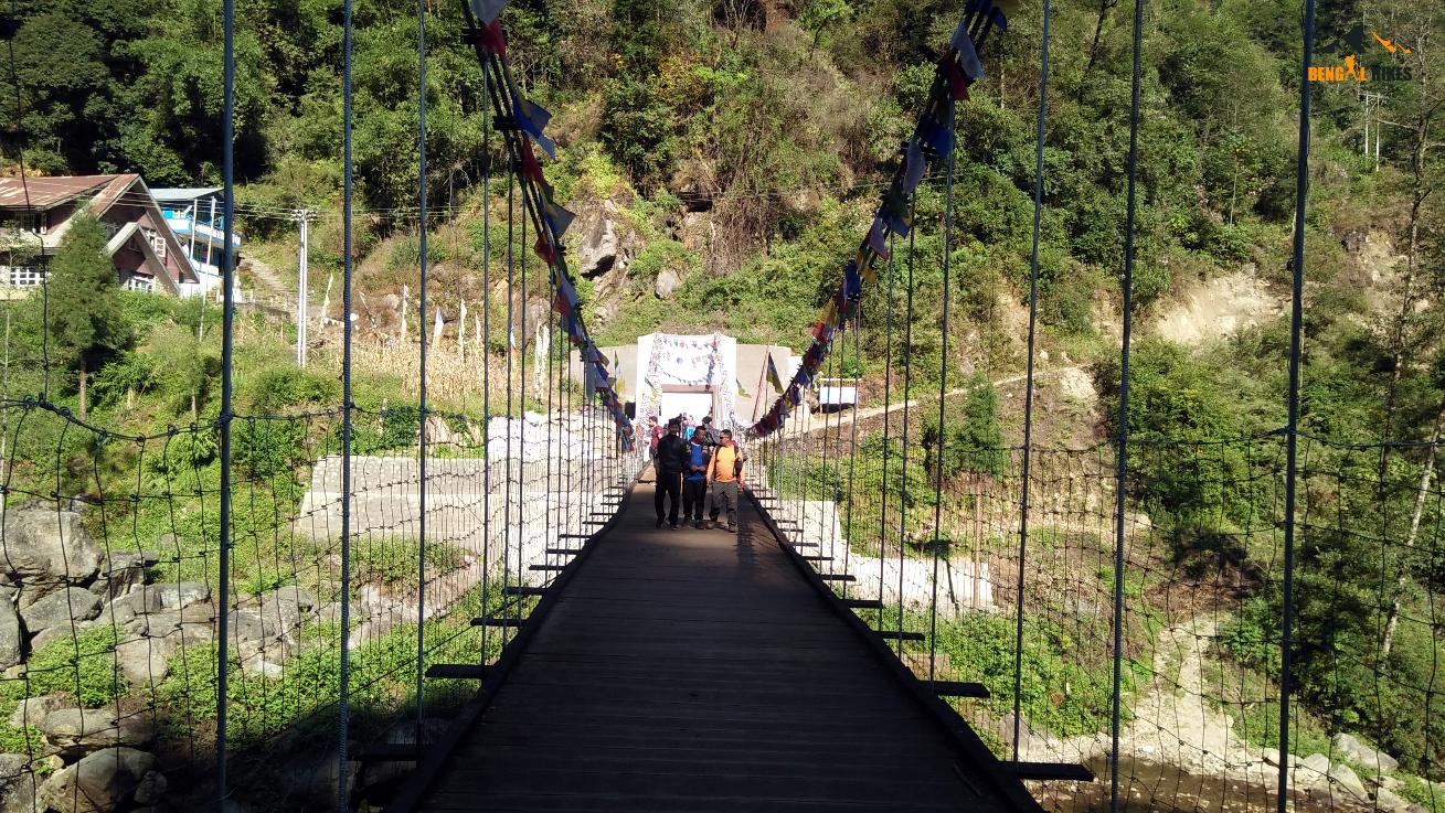
Today morning after breakfast we continue our descent along the river and reach Srikhola in one hour or so. Our trek ends here . An old suspension bridge connects the motor road on the other side towards Rimbick. We take the car back to NJP/Siliguri. We will cross Rimbick, and the road goes either through Dhotrey or Bijanbari to finally Siliguri. If you have few days extra to carry on with vacation, then you can move out towards Darjeeling town which is 90 Km from Srikhola and takes around 4 hour. Though we are not a hotel booking or car sightseeing agency but maybe able to help you.
P.S: Distances and altitudes are approximate and may not be exact.
© Copyright bengalhikes